


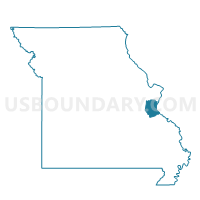
Springdale Voting District, Jefferson County, Missouri
About
Outline

Summary
| Unique Area Identifier | 608858 |
| Name | Springdale Voting District |
| County | Jefferson County |
| State | Missouri |
| Area (square miles) | 5.40 |
| Land Area (square miles) | 5.12 |
| Water Area (square miles) | 0.28 |
| % of Land Area | 94.88 |
| % of Water Area | 5.12 |
| Latitude of the Internal Point | 38.48946560 |
| Longtitude of the Internal Point | -90.42768050 |
Maps


Graphs
Select a template below for downloading or customizing gragh for Springdale Voting District, Jefferson County, Missouri


Neighbors
Neighoring Voting District (by Name) Neighboring Voting District on the Map
- BON037 Voting District, St. Louis County, MO
- BON206 Voting District, St. Louis County, MO
- Meramec Heights Voting District, Jefferson County, MO
- Murphy No. 2 Voting District, Jefferson County, MO
- Rock Creek No. 1 Voting District, Jefferson County, MO
- Romaine Creek Voting District, Jefferson County, MO
- Saline Voting District, Jefferson County, MO
- TSF002 Voting District, St. Louis County, MO
- TSF009 Voting District, St. Louis County, MO
- TSF010 Voting District, St. Louis County, MO
- TSF020 Voting District, St. Louis County, MO
Top 10 Neighboring County Subdivision (by Population) Neighboring County Subdivision on the Map
- Tesson Ferry township, St. Louis County, MO (38,546)
- Bonhomme township, St. Louis County, MO (36,316)
- Rock township, Jefferson County, MO (31,460)
- Windsor township, Jefferson County, MO (22,228)
Top 10 Neighboring Place (by Population) Neighboring Place on the Map
Top 10 Neighboring Unified School District (by Population) Neighboring Unified School District on the Map
- Mehlville School District, MO (95,468)
- Fox C-6 School District, MO (67,955)
- Lindbergh R-VIII School District, MO (46,429)
- Northwest R-I School District, MO (45,694)
Top 10 Neighboring State Legislative District Lower Chamber (by Population) Neighboring State Legislative District Lower Chamber on the Map
- State House District 102, MO (38,929)
- State House District 90, MO (36,548)
- State House District 97, MO (35,274)
- State House District 95, MO (33,750)
Top 10 Neighboring State Legislative District Upper Chamber (by Population) Neighboring State Legislative District Upper Chamber on the Map
- State Senate District 22, MO (176,515)
- State Senate District 15, MO (168,516)
- State Senate District 1, MO (167,418)
Top 10 Neighboring 111th Congressional District (by Population) Neighboring 111th Congressional District on the Map
Top 10 Neighboring Census Tract (by Population) Neighboring Census Tract on the Map
- Census Tract 2212.02, St. Louis County, MO (6,067)
- Census Tract 7002.03, Jefferson County, MO (6,005)
- Census Tract 2213.35, St. Louis County, MO (5,830)
- Census Tract 7002.08, Jefferson County, MO (5,818)
- Census Tract 2214.23, St. Louis County, MO (4,035)
- Census Tract 7002.10, Jefferson County, MO (3,923)
- Census Tract 2220, St. Louis County, MO (3,818)
- Census Tract 7002.09, Jefferson County, MO (3,479)
- Census Tract 7001.19, Jefferson County, MO (2,145)